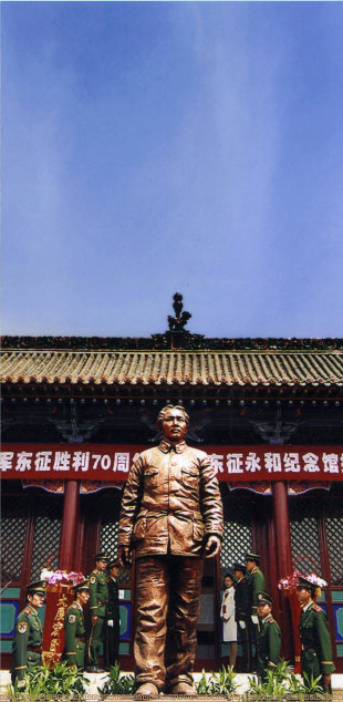
 The Yonghe Memorial Hall for the Chinese Workers’ and Peasants’ Red Army Expedition East
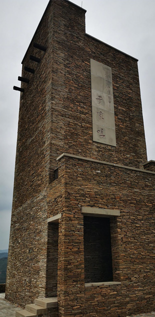
It is located in Dongzheng Village, Qiankunwan Township, and was built in 1972. It faces south on the north and covers 7,200 square meters, consisting of five themed exhibition halls, a temporary residence of Chairman Mao, and an incorruptness education base. Herein, Chairman Zedong Mao's great achievements are intensively, comprehensively, and detailedly displayed in ……
 The
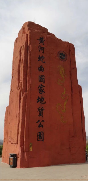
TheThe "0 KM" Logo Cultural Station, covering an area of 8,000 square meters, is located in Qiankunwan Township on the southwest of the Yonghe county town. At the center, there stands the landscape stone of "0 KM" landmark. It is connected in series with the functional zones such as the “Yellow River Culture Park”, “Son of the Yellow River” Theme Sculptures, Zaolin Bay, Yellow River Walking Trail, Viewing Platform, Digital Photography Interactive Platform, ……
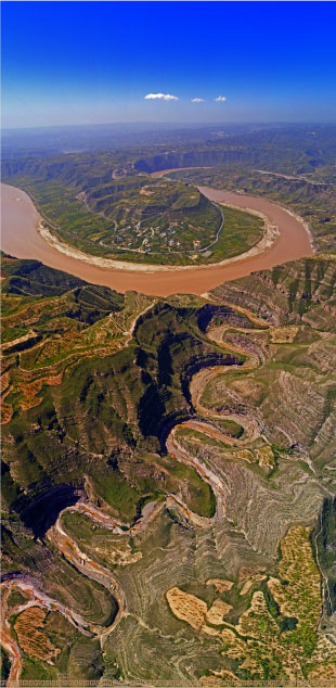
 The Yellow River “Snaky Landform” National Geopark
It is located in the west of Yonghe County, Shanxi Province and on the east bank of the Shanxi-Shaanxi Gorge which exists in the middle reach of the Yellow River. It starts from Qianbeitou Village in the north, ends at the Fotang Village in the south, reaches the middle line of the Yellow River in the west, and is close to the Forty-Mile Mountain in the east, with a total area of 105.6 km2.……
 The Xianren Cave
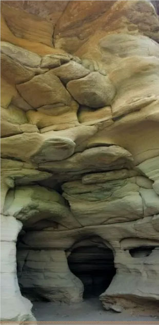
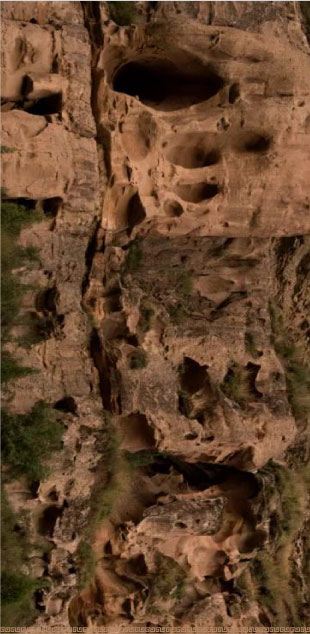
The Xianren Cave is a water-erosion cave, which is located on the southwest bank of Yujiazui Village, Qiankunwan Township. There is an ancient legend about Fuxi, the ancestor of the humanities, once stayed here to deduce Tai Chi and the Eight Trigrams. Hence it was named as "An Immortal Cave ".
 The Three-North Shelter Forest Program
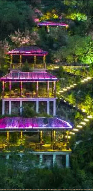
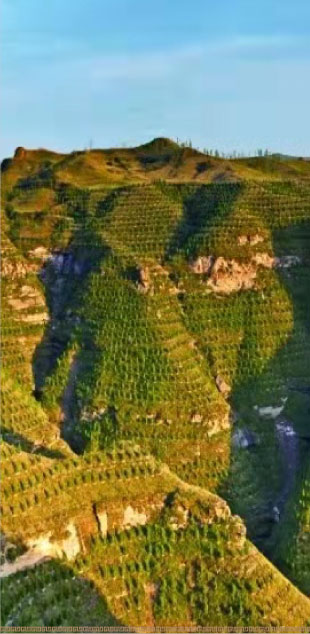
Since the 1970s, the previous Yonghe County Party Committee and Government led all the local people to plant trees continuously. Using the new techniques such as transportation of soil to backfill through PVC pipes and transportation of nursery stocks through ropeway, they succeeded in planting 760,000 acres of trees in the rocky mountains above the angle of
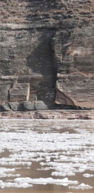 Red cliff
Located in wanghai Temple township yonghe pass near the bank of the Yellow River on the cliff. In June 1936, the red xv corps covered the retreat of the main force of the 6th company of the 241st regiment of the 81st Division, and the remaining 12 warriors were trapped in the high mountains by enemy forces several times larger than their own. Twelve Red Army soldiers who ran out of ammunition and food after days of fierce fighting……
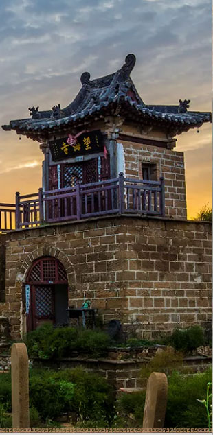 Looking at the sea temple
Wanghai Temple was founded in an unknown age. According to the Inscription of Yonghe County in the Republic of China, it was renovated in the first year of Qianlong's reign in the Qing Dynasty (1736) and the 24th year of the Republic of China (1934). Facing south, covering an area of 1065.7 square meters, there are only main hall West Ear Hall, Kuixing Building......
 Yujiazui Ferry
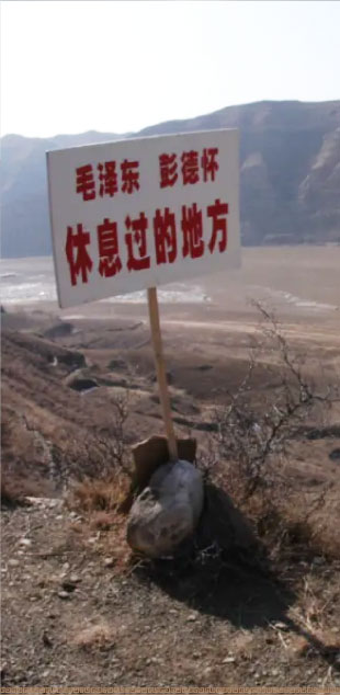
The Yujiazui Ferry is located in the west of Yujiazui Village, Qiankunwan Township. As one of the main ancient ferries on the east bank of the Yellow River, it coordinates each other with the distant Qingshuiguan Ferry in Yanchuan County, Shaanxi Province. With a wide terrain and gentle port, it is convenient for armies to assemble and thus, it is always a battleground for military strategists. From May 2 to 5, ……
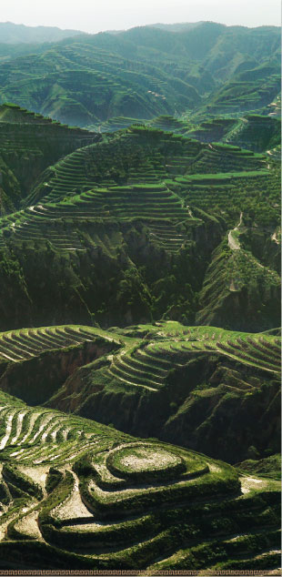
 Mt. Geshan
Mt. Geshan, also known as Wulong Mountain, is 22.5 kilometers away from southwest of the county town. It has an altitude of 1,235 meters, with the east and west peaks being connected, resembling a Yuanbao (a shoe-shaped gold or silver ingot used as money in ancient China). In "Yonghe County Annals" in the forty-ninth year of Kangxi (1710), it was documented as: "Wulong Mountain appeared here in the year of 564, the third year of Heqing in Beiqi Dynasty (the Northern Qi Dynasty). It is strategically located and difficult of access, together with the Yellow River forming the interior and exterior barrier. Often, the soldiers stationed there to defend.”
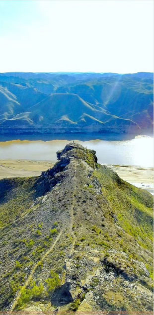 Majiawan comes out on top
Yellow River No. 1 tourist highway "0km" sign culture station is composed of marker stone, experience center, snake winding footpath, parking lot and service facilities. "0KM" sign landscape stone 13.8 meters long, 1.7 meters wide, 4.5 meters high, about 135 tons. Through the Yellow River for a long time……
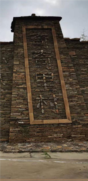 Qiqi village
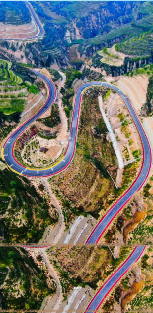
Located in the west of yonghe county, the southern end of the Luliang Mountains, the middle reaches of the Yellow River Jinshan Grand Canyon east bank. Qiqili village is a pioneer in promoting tourism in poor mountainous areas with video art. The village covers an area of 1074 hectares, with 7.3 kilometers of tourist road winding through the mountains to reach heaven and earth……
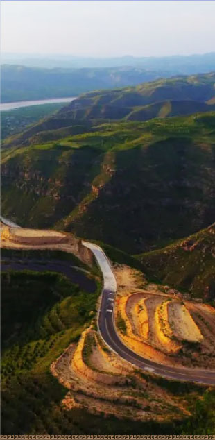 Yinde River ancient village
Yin De He village is located in The Qikun Bay scenic area of Gedi township. The people of Yin de He village are descendants of the big Locust tree immigrants. All the villagers are surnamed Guo. The village name comes from qiankun Bay, formerly called Duck River village, is still preserved xiongnu style……
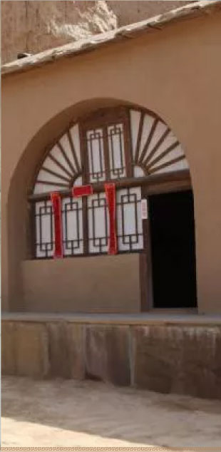 Zhao ditch
Zhaojia ditch chairman road position in Yonghe County Po Tou township Zhaojia Ditch village, March 29, 1936, MAO Zedong, Peng Dehuai in Zhaojia Ditch issued "The Chinese people's Anti-japanese Red Army northwest Military committee against Japan to inform the national people's book", to stop all civil war……
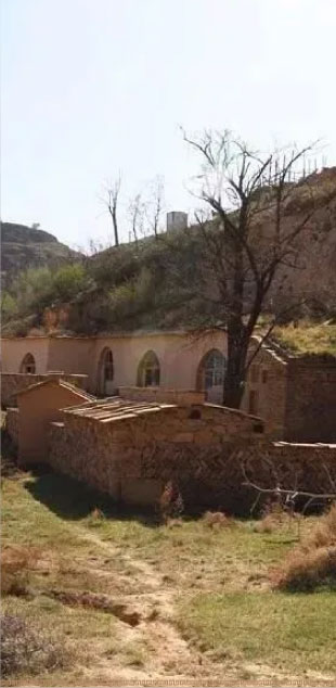 Before the dragon stone waist
Former longshi waist chairman road position in yonghe County sangbi town before longshi waist village. In late April 1936, MAO Zedong led the red Army headquarters arrived in Sangbi town, Yonghe County, according to the changes in the enemy situation, the Red Army made the decision to return to the west.
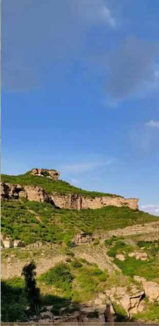 Double lock mountain
Shuangsuo Mountain is located 15 kilometers southeast of Yonghe county. It is named after the confrontation between the two mountains and is commonly known as Shimen Mountain. With an altitude of more than 1520 meters, it is famous for the famous heroine Of the Southern Tang Dynasty, Liu Jinding, who camped here to defend the Liao dynasty. Mountain liu Jinding temple, Guanyin grottoes, dozen house
 Chessboard hill
Chipan Mountain is located 12 kilometers southwest of the county seat, with an altitude of 1241.3 meters. Tang Lou Shan county in this, because of Lou Shan and relative, once known as north Lou Shan; And because the top of the mountain there is a big stone, stone on a chessboard, so named Chess panshan. The peak far view pull according to the sky, towering into the clouds, qiaoqiang rock wall, the momentum male
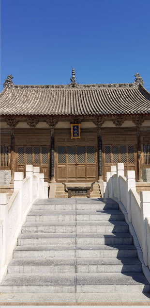 Dacheng Hall of Yonghe Confucian Temple
Dacheng Hall of Yonghe Confucian Temple is located in The county seat of Yonghe County. According to yonghe County Annals of the Republic of China, the forty-third year (1704), forty-sixth year (1707), eighth year (1743) of The Reign of Emperor Qianlong, nineteenth year (1814) and twenty-ninth year of jiaqing
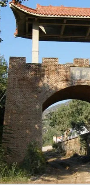 Yonghe shut
Yonghe Pass is located in Nanzhuang township, 35 kilometers west of Yonghe county. It is one of the historic ferry ports and also a traffic fortress to shaanxi. Legend here was once the site of yonghe old county, the city wall, beacon tower, Yu Wang Denggu, shou Guan dog, qiancheng Ping, Houcheng Ping and other sites well preserved
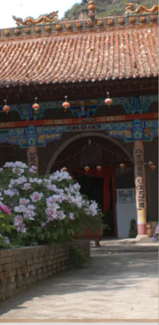 Chaoyang temple,
According to the stone tablet in the temple, it is recorded in the 28th year of Jiajing of Ming Dynasty (1549), the 2nd year of Longqing (1568), the 4th year of Wanli (1576), the 8th year of Longqing (1580) and the 13th year of Wanli (1585), the 5th year of Kangxi of Qing Dynasty (1666), the 47th year of Qianlong (1782) and Guangxu
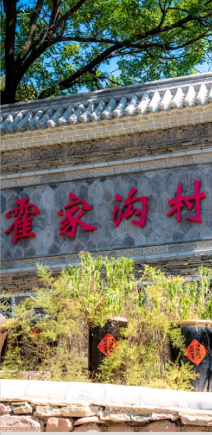 Huojiagou Ancient village
Huojiagou is located in the middle of Zhihe Town, 10 kilometers away from the county seat, which is a typical representative of ancient civilized villages. The village's ancient cave dwellings remain intact, distinct, highly ornamental. The existing natural vegetable picking garden, rural memory museum, etc., is a good place for city residents to relax and entertain.
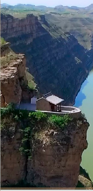 Nuwa temple
Nuwa Temple is located in Nanzhuang township, the existing buildings for the Qing Dynasty. Built on the east bank of the Yellow River, the semi-circular plane, covering an area of about 139.3 square meters. There are three new plastic statues in the temple, a unique temple building on the bank of the Yellow River, yonghe County was announced as the county level in 2012...
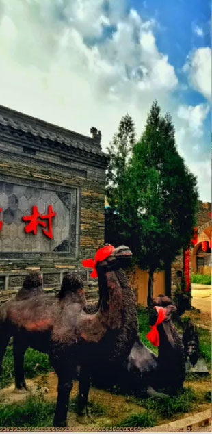 Thousands of years old village -- Cable camel
Suotuo village has a long history and is an ancient village for thousands of years. Since ancient times, it has been the key road for entering and leaving Yonghe, where the merchants ask for or look for camels, chariots and horses and other draft animals and burden tools for riding, hence the name "Suotuo" (suotuo). There are still relics of ancient post stations in the village.
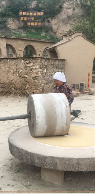 Shanhuangli Folk Village
Located in yonghe County hit stone waist township xinsheguo village committee hill Huang Li village, 18 kilometers away from the county seat. There are ancient dwellings and caves in qing Dynasty, and newly built stage, full of profound cultural deposits. There are more than 500 meters of ancient tunnels, which store stone grinding, stone grinding. Existing ancient cave 36 holes, ancient cave......
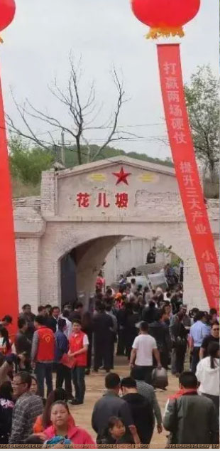 Huapo Grain Station
Huapo grain station is located in the north 50 meters of Huapo village, Xinsheguo village, Dashiyao township. In 1969, a grain depot, a dormitory, an office and a gate were built. The dormitory was a stone bond cave with 5 holes. The gate is located in the northeast corner of the grain station, the arch door facade......